
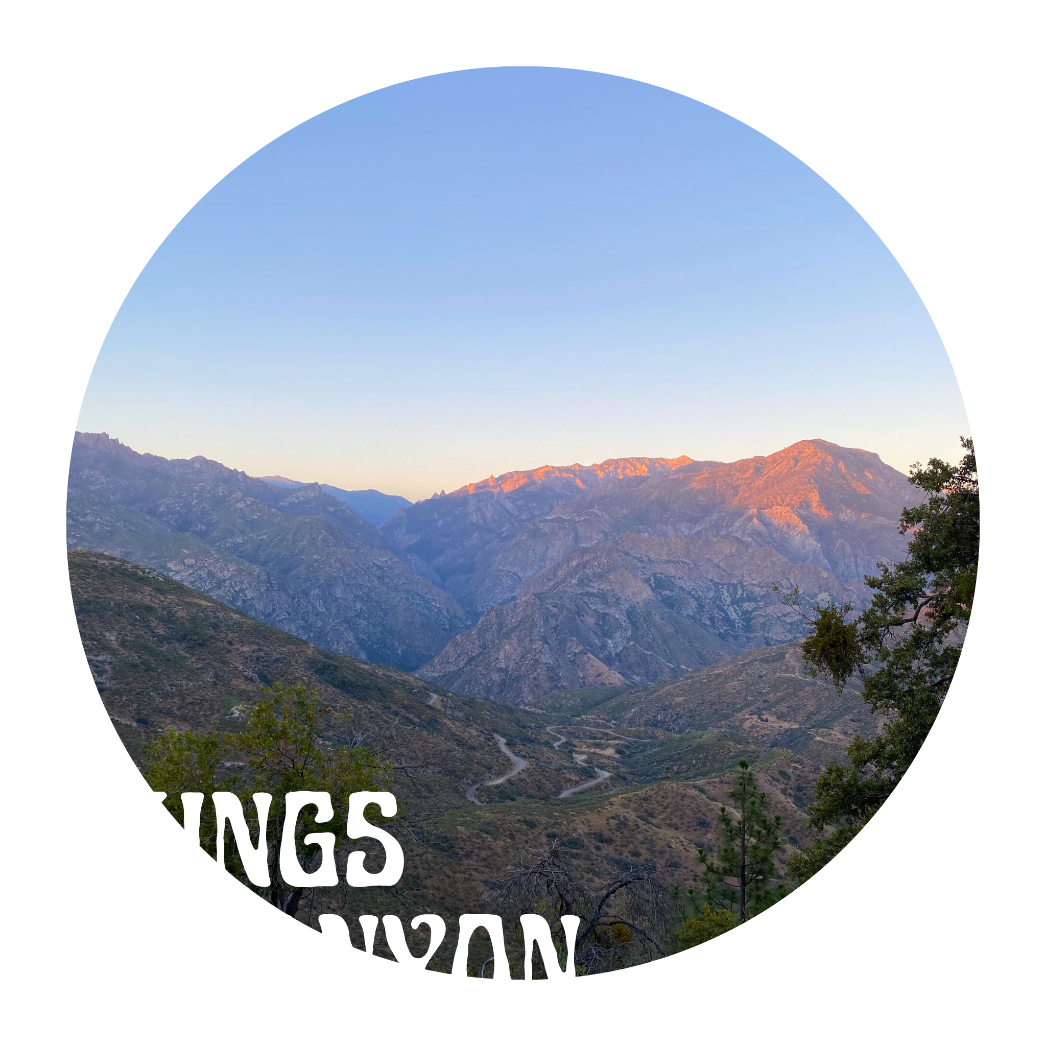

Kings Canyon National Park, July 28th 2020.
Unlike our drive into Sequoia, approaching Kings Canyon really felt like we were driving into the untamed. You can definitely feel the “nature” around you in Sequoia, but in Kings Canyon it’s hard to imagine anything else. We came in from CA-180 and our first stop was Panorama Point. A quick detour off CA-180 right as you’re going through Grant’s Village. Panorama Point offers a small parking lot and at our arrival in the morning, only two other cars were there. A very quick paved path takes you to a few viewpoints on the mountainside – and the best view we found was on an outcropping with large rocks. From up here, you can see so much of the surrounding mountains and even get a look down into the valley and the popular Hume Lake. We got here in the morning, so everything was lit up by the sun. The views were amazing – a great way to start our second day – and of course, we took plenty of pictures. 
Continuing along CA-180, our next stop was Grizzly Falls. It’s a picnic area – with a parking lot and some picnic tables set up for those who choose to stop. A VERY short walk past the picnic tables takes you to a steep waterfall and small stream. The stream runs beneath CA-180 to the large river that flows on the other side of the road. We parked and headed straight to the falls. People were taking photos from both sides of the stream, with the tall falls in the background. After getting some pictures of our own, we decided to go off-trail to see if there was a way to climb to the top of the falls. Learn from our mistake, DON’T TRY IT! First of all, the surrounding area is too steep and too full of brush and plant life to be able to make a climb to the top… and speaking of plant life – it’s all poison ivy. We didn’t find out until 3-4 days later, but we all discovered to have a case of poison ivy when we got back home.
After checking out the Grizzly Falls picnic area, we actually got our lunch out of the car and crossed the road. We climbed down to the swiftly flowing river and sat on some large rocks in the riverbed for lunch. The cold water was flowing so forcefully through the rocks that we simply ate and went on our way – this wasn’t the place for a swim. 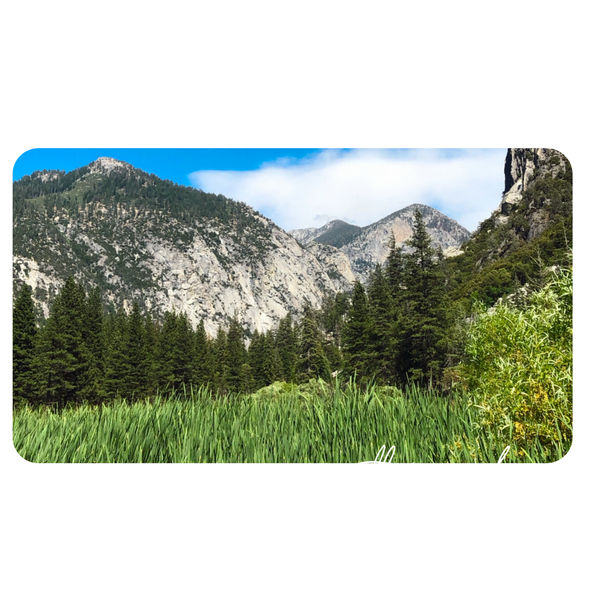
Our next stop was the Zumwalt Meadows hike, close to Road’s End. This hike starts in the woods, crosses a sturdy bridge over the river, that takes you back into a small woods, before opening up into the large, open meadows. Unfortunately, our hike ended right here as the loop trail that actually goes around the meadows was closed. This turned into a shorter hike than expected, because of the closure, but we were glad that we got to see the meadows – even if we couldn’t do the full hike around them. The meadows are next to a river and the small marshy area in between them was full of bugs – we didn’t stay long. We quickly re-traced our steps and went back to the car… on to the next one. 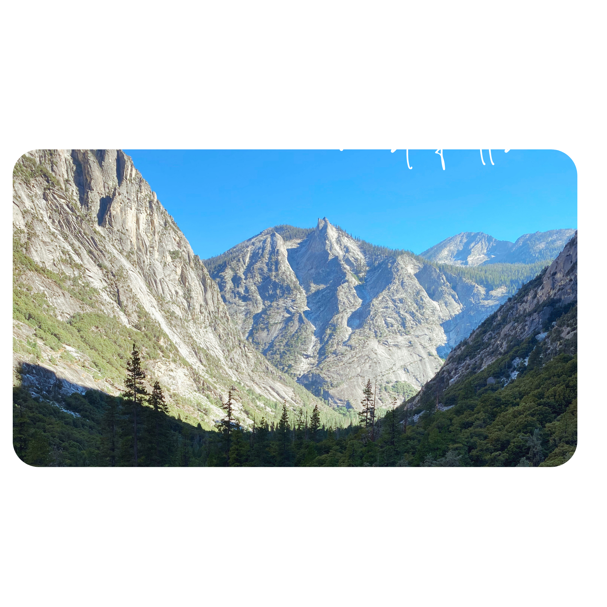
Finally, traveling along CA-180, we reached Road’s End. From here, backpackers can take off on hiking trails that take weeks to complete. We chose one of the few options that could be done in a day – Mist Falls. Mist Falls is an out-and-back trail that is almost 9 miles in total. It took us about 4-5 hours to complete with a few stops along the way.
This trail really had everything – it was undoubtedly our favorite hike of the whole weekend. This trail went through the woods alongside a river, then as we went deeper it became a thick green jungle, that eventually opened up to a rocky mountain side. From here, it seemed like we were really climbing straight up the side of a mountain for a while, on a trail carved into the rocks. Along this part of the journey, we witnessed the river rushing thinly down the slippery rock nearby and occasionally we would catch falls along the way as we climbed higher.
Halfway up the rocky part of the climb, we turned around and spotted one of the greatest views of the trip. We were now above the wooded valley we had been hiking through and could see it displayed for miles beneath the mountainous boundaries. We stopped to document the view, then knew we had to keep going further.
As we got higher up the rocks, the hike became wooded again and we wondered if we had gone to far. Just as we were beginning to think we should turn around, we could feel the mist of the falls. It was crazy to us how far away we were when we started to feel the spray! As we got closer, we knew there was no way we could get anywhere near the falls without getting wet… it was already starting to dampen our clothes from hundreds of feet away. Luckily, we had rain jackets in our packs – so we zipped up and got closer.
We climbed up onto the rocks at the bottom of the falls, or as close to the falls as we could get. We knew we’d be drying off once we were done taking it all in, so Brady got to bust out his Georgia towel as well. Once we were ready to go, we walked farther away from the spray, dried off, and had some snacks. Then, it was time to do the whole hike backward again. We didn’t mind at all, as this was one of the coolest hikes any of us had done.
National Park Rating: 4 out of 5 stars.
Leave a comment